
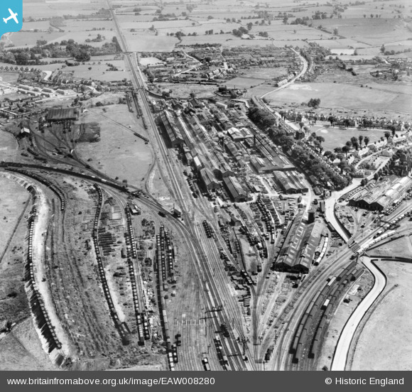
EAW008280 ENGLAND (1947). The Southern Railway Works, Ashford, 1947
© Copyright OpenStreetMap contributors and licensed by the OpenStreetMap Foundation. 2024. Cartography is licensed as CC BY-SA.
Nearby Images (8)
EAW008280

EAW008276

EPW026085

EPW000521

EAW008279

EAW008271

EAW008282

EAW008275

Details
| Title | [EAW008280] The Southern Railway Works, Ashford, 1947 |
| Reference | EAW008280 |
| Date | 15-July-1947 |
| Link | |
| Place name | ASHFORD |
| Parish | |
| District | |
| Country | ENGLAND |
| Easting / Northing | 601708, 141769 |
| Longitude / Latitude | 0.88374106658187, 51.139078252164 |
| National Grid Reference | TR017418 |
Pins
 Sparky |
Sunday 1st of October 2017 10:37:03 PM | |
B.R.E.L.I.E. |
Thursday 3rd of April 2014 09:12:51 PM | |
MB |
Wednesday 13th of November 2013 05:28:22 PM | |
MB |
Wednesday 13th of November 2013 05:27:20 PM | |
MB |
Wednesday 13th of November 2013 05:26:20 PM | |
MB |
Wednesday 13th of November 2013 05:24:22 PM | |
MB |
Wednesday 13th of November 2013 05:23:08 PM | |
MB |
Wednesday 13th of November 2013 05:22:38 PM | |
MB |
Wednesday 13th of November 2013 05:22:08 PM | |
MB |
Wednesday 13th of November 2013 05:21:44 PM |
User Comment Contributions
Camouflaged roofs |
MB |
Wednesday 13th of November 2013 05:20:24 PM |


