
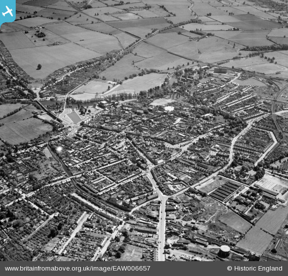
EAW006657 ENGLAND (1947). The town centre, Stratford-upon-Avon, from the north-west, 1947
© Copyright OpenStreetMap contributors and licensed by the OpenStreetMap Foundation. 2024. Cartography is licensed as CC BY-SA.
Nearby Images (4)
EAW006657

EPW010489

EPW010478

EPW010484

Details
| Title | [EAW006657] The town centre, Stratford-upon-Avon, from the north-west, 1947 |
| Reference | EAW006657 |
| Date | 28-May-1947 |
| Link | |
| Place name | STRATFORD-UPON-AVON |
| Parish | STRATFORD-UPON-AVON |
| District | |
| Country | ENGLAND |
| Easting / Northing | 419932, 255360 |
| Longitude / Latitude | -1.7083582207743, 52.195712654661 |
| National Grid Reference | SP199554 |
Pins
 SK |
Friday 24th of September 2021 09:00:33 PM | |
SK |
Friday 24th of September 2021 08:58:47 PM | |
SK |
Friday 24th of September 2021 08:58:37 PM | |
SK |
Friday 24th of September 2021 08:58:09 PM | |
SK |
Friday 24th of September 2021 08:57:45 PM | |
SK |
Friday 24th of September 2021 08:57:30 PM | |
SK |
Wednesday 22nd of September 2021 09:29:13 PM | |
tony |
Friday 20th of May 2016 08:37:00 PM | |
tony |
Monday 23rd of March 2015 09:39:06 PM | |
tony |
Monday 23rd of March 2015 09:38:14 PM | |
tony |
Monday 23rd of March 2015 09:37:19 PM | |
tony |
Monday 23rd of March 2015 09:36:08 PM | |
tony |
Wednesday 4th of March 2015 03:23:56 PM | |
tony |
Wednesday 28th of January 2015 04:38:47 PM | |
tony |
Wednesday 28th of January 2015 04:37:07 PM | |
tony |
Wednesday 28th of January 2015 04:34:43 PM | |
tony |
Wednesday 28th of January 2015 04:33:40 PM | |
tony |
Wednesday 28th of January 2015 04:32:12 PM | |
tony |
Wednesday 28th of January 2015 04:31:26 PM |


