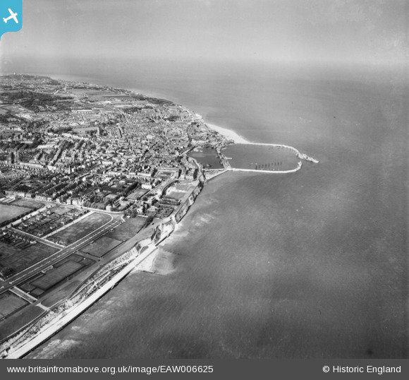
EAW006625 ENGLAND (1947). The Royal Harbour and town, Ramsgate, from the south-west, 1947
© Copyright OpenStreetMap contributors and licensed by the OpenStreetMap Foundation. 2024. Cartography is licensed as CC BY-SA.
Nearby Images (7)
EAW006625

EPW039356

EPW000090

EPW000097

EAW009025

EPW052895

EPW052885

Details
| Title | [EAW006625] The Royal Harbour and town, Ramsgate, from the south-west, 1947 |
| Reference | EAW006625 |
| Date | 27-May-1947 |
| Link | |
| Place name | RAMSGATE |
| Parish | RAMSGATE |
| District | |
| Country | ENGLAND |
| Easting / Northing | 637797, 164084 |
| Longitude / Latitude | 1.4135965325101, 51.32555335065 |
| National Grid Reference | TR378641 |
Pins
 Alan McFaden |
Sunday 13th of July 2014 05:52:56 PM | |
Alan McFaden |
Sunday 13th of July 2014 05:52:17 PM | |
Alan McFaden |
Sunday 13th of July 2014 05:51:36 PM | |
 Mike Floate |
Sunday 27th of April 2014 07:54:29 PM | |
Mike Floate |
Sunday 27th of April 2014 07:50:08 PM |