
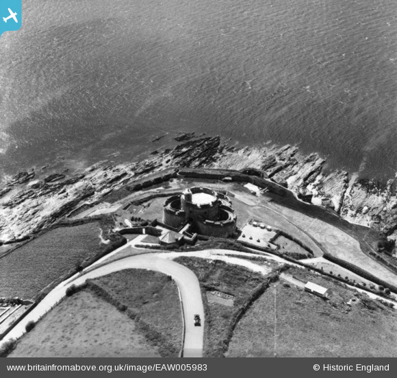
EAW005983 ENGLAND (1947). St Mawes Castle, St Mawes, 1947. This image has been produced from a print.
© Copyright OpenStreetMap contributors and licensed by the OpenStreetMap Foundation. 2024. Cartography is licensed as CC BY-SA.
Nearby Images (7)
EAW005983

EAW005982

EAW005984

EAW005980

EAW014984

EAW005981

EAW014985

Details
| Title | [EAW005983] St Mawes Castle, St Mawes, 1947. This image has been produced from a print. |
| Reference | EAW005983 |
| Date | 18-May-1947 |
| Link | |
| Place name | ST MAWES |
| Parish | ST. JUST-IN-ROSELAND |
| District | |
| Country | ENGLAND |
| Easting / Northing | 184096, 32712 |
| Longitude / Latitude | -5.0228298970959, 50.154456718605 |
| National Grid Reference | SW841327 |
Pins
 redmist |
Monday 29th of August 2022 06:48:17 PM | |
redmist |
Monday 29th of August 2022 06:47:07 PM | |
redmist |
Monday 29th of August 2022 06:44:45 PM | |
redmist |
Monday 29th of August 2022 06:44:11 PM |


