
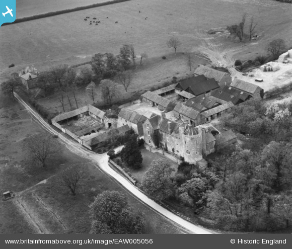
EAW005056 ENGLAND (1947). Somerton Castle, Boothby Graffoe, 1947. This image has been produced from a print.
© Copyright OpenStreetMap contributors and licensed by the OpenStreetMap Foundation. 2024. Cartography is licensed as CC BY-SA.
Nearby Images (5)
EAW005056

EAW005054

EAW005058

EAW005057

EAW005055

Details
| Title | [EAW005056] Somerton Castle, Boothby Graffoe, 1947. This image has been produced from a print. |
| Reference | EAW005056 |
| Date | 8-May-1947 |
| Link | |
| Place name | BOOTHBY GRAFFOE |
| Parish | BOOTHBY GRAFFOE |
| District | |
| Country | ENGLAND |
| Easting / Northing | 495408, 358763 |
| Longitude / Latitude | -0.57430026708207, 53.117205342003 |
| National Grid Reference | SK954588 |
Pins
Be the first to add a comment to this image!


