
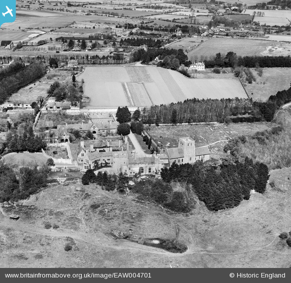
EAW004701 ENGLAND (1947). Lympne Castle, St Stephen's Church and the village, Lympne, 1947
© Copyright OpenStreetMap contributors and licensed by the OpenStreetMap Foundation. 2024. Cartography is licensed as CC BY-SA.
Nearby Images (7)
EAW004701

EAW004700

EAW004697

EAW004699

EAW004696

EAW004698

EAW004695

Details
| Title | [EAW004701] Lympne Castle, St Stephen's Church and the village, Lympne, 1947 |
| Reference | EAW004701 |
| Date | 26-April-1947 |
| Link | |
| Place name | LYMPNE |
| Parish | LYMPNE |
| District | |
| Country | ENGLAND |
| Easting / Northing | 611952, 134716 |
| Longitude / Latitude | 1.0258396082915, 51.072038145268 |
| National Grid Reference | TR120347 |


