
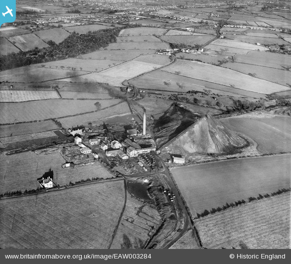
EAW003284 ENGLAND (1946). Cotes Park Colliery, Cotes Park, 1946
© Copyright OpenStreetMap contributors and licensed by the OpenStreetMap Foundation. 2024. Cartography is licensed as CC BY-SA.
Nearby Images (14)
EAW003284

EAW003279

EAW003283

EAW003285

EAW003282

EAW003277

EAW002812

EAW003278

EAW002813

EAW003286

EAW002814

EAW003276

EAW003281

EAW003280

Details
| Title | [EAW003284] Cotes Park Colliery, Cotes Park, 1946 |
| Reference | EAW003284 |
| Date | 4-November-1946 |
| Link | |
| Place name | COTES PARK |
| Parish | SOMERCOTES |
| District | |
| Country | ENGLAND |
| Easting / Northing | 442708, 355032 |
| Longitude / Latitude | -1.3622162793763, 53.090491197746 |
| National Grid Reference | SK427550 |
Pins
 dd1000 |
Thursday 18th of July 2019 11:51:08 AM | |
dd1000 |
Wednesday 17th of July 2019 08:37:27 PM | |
dd1000 |
Wednesday 17th of July 2019 08:36:49 PM | |
dd1000 |
Wednesday 17th of July 2019 08:34:01 PM | |
dd1000 |
Wednesday 17th of July 2019 08:33:37 PM | |
dd1000 |
Wednesday 17th of July 2019 08:32:13 PM |


