
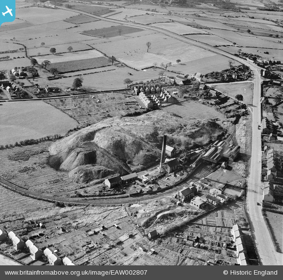
EAW002807 ENGLAND (1946). The New Selston Colliery, Selston, 1946
© Copyright OpenStreetMap contributors and licensed by the OpenStreetMap Foundation. 2024. Cartography is licensed as CC BY-SA.
Nearby Images (18)
EAW002807

EAW003287

EAW003291

EAW002810

EAW003294

EAW003297

EAW003290

EAW003298

EAW003292

EAW003288

EAW003293

EAW003299

EAW003296

EAW003289

EAW002811

EAW003295

EAW002808

EAW002809

Details
| Title | [EAW002807] The New Selston Colliery, Selston, 1946 |
| Reference | EAW002807 |
| Date | 27-September-1946 |
| Link | |
| Place name | SELSTON |
| Parish | SELSTON |
| District | |
| Country | ENGLAND |
| Easting / Northing | 445726, 352761 |
| Longitude / Latitude | -1.3174730666892, 53.069826124214 |
| National Grid Reference | SK457528 |


