
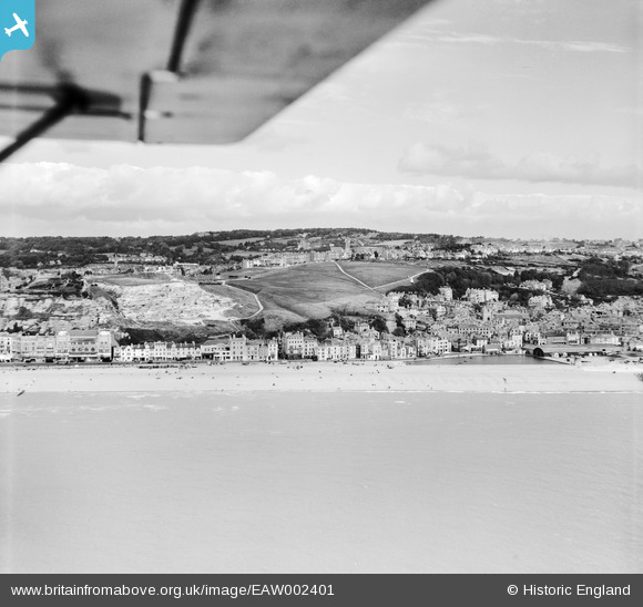
EAW002401 ENGLAND (1946). The seafront, West Hill and Castle Hill, Hastings, from the south, 1946
© Copyright OpenStreetMap contributors and licensed by the OpenStreetMap Foundation. 2024. Cartography is licensed as CC BY-SA.
Nearby Images (16)
EAW002401

EPW039368

EPW042837

EPW000675

EPW039365

EPW039367

EPW035338

EPW026205

EAW006148

EAW006151

EPW000111

EAW006149

EPW000105

EPW026189

EPW026195

EAW002400

Details
| Title | [EAW002401] The seafront, West Hill and Castle Hill, Hastings, from the south, 1946 |
| Reference | EAW002401 |
| Date | 16-September-1946 |
| Link | |
| Place name | HASTINGS |
| Parish | |
| District | |
| Country | ENGLAND |
| Easting / Northing | 582265, 109400 |
| Longitude / Latitude | 0.58984510021519, 50.854794987909 |
| National Grid Reference | TQ823094 |
Pins
 redmist |
Tuesday 5th of December 2023 09:38:01 AM | |
redmist |
Tuesday 5th of December 2023 09:32:05 AM | |
redmist |
Tuesday 5th of December 2023 09:29:36 AM | |
redmist |
Tuesday 11th of October 2022 09:07:55 PM |


