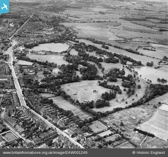
EAW001249 ENGLAND (1946). Dartmouth Park, Mayer's Green, 1946
© Copyright OpenStreetMap contributors and licensed by the OpenStreetMap Foundation. 2024. Cartography is licensed as CC BY-SA.
Nearby Images (7)
Details
| Title | [EAW001249] Dartmouth Park, Mayer's Green, 1946 |
| Reference | EAW001249 |
| Date | 24-June-1946 |
| Link | |
| Place name | MAYER'S GREEN |
| Parish | |
| District | |
| Country | ENGLAND |
| Easting / Northing | 401278, 291275 |
| Longitude / Latitude | -1.9811635805025, 52.518990285907 |
| National Grid Reference | SP013913 |


![[EAW001249] Dartmouth Park, Mayer's Green, 1946](http://britainfromabove.org.uk/sites/all/libraries/aerofilms-images/public/100x100/EAW/001/EAW001249.jpg)
![[EAW001247] Dartmouth Park, Mayer's Green, 1946](http://britainfromabove.org.uk/sites/all/libraries/aerofilms-images/public/100x100/EAW/001/EAW001247.jpg)
![[EAW001250] The Boating Lake at Dartmouth Park, Mayer's Green, 1946](http://britainfromabove.org.uk/sites/all/libraries/aerofilms-images/public/100x100/EAW/001/EAW001250.jpg)
![[EAW001246] Dartmouth Park, Mayer's Green, 1946](http://britainfromabove.org.uk/sites/all/libraries/aerofilms-images/public/100x100/EAW/001/EAW001246.jpg)
![[EAW001252] Dartmouth Park, Mayer's Green, 1946](http://britainfromabove.org.uk/sites/all/libraries/aerofilms-images/public/100x100/EAW/001/EAW001252.jpg)
![[EAW001251] Dartmouth Park, Mayer's Green, 1946](http://britainfromabove.org.uk/sites/all/libraries/aerofilms-images/public/100x100/EAW/001/EAW001251.jpg)
![[EPW021863] Dartmouth Park and Pleasure Pool, West Bromwich, from the south-west, 1928](http://britainfromabove.org.uk/sites/all/libraries/aerofilms-images/public/100x100/EPW/021/EPW021863.jpg)


