
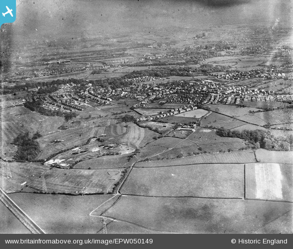
EPW050149 ENGLAND (1936). The Penwortham Sewage Works, the town and environs, Penwortham, from the north-west, 1936
© Hawlfraint cyfranwyr OpenStreetMap a thrwyddedwyd gan yr OpenStreetMap Foundation. 2024. Trwyddedir y gartograffeg fel CC BY-SA.
Delweddau cyfagos (2)
EPW050149

EPW050153

Manylion
| Pennawd | [EPW050149] The Penwortham Sewage Works, the town and environs, Penwortham, from the north-west, 1936 |
| Cyfeirnod | EPW050149 |
| Dyddiad | May-1936 |
| Dolen | |
| Enw lle | PENWORTHAM |
| Plwyf | PENWORTHAM |
| Ardal | |
| Gwlad | ENGLAND |
| Dwyreiniad / Gogleddiad | 351032, 428892 |
| Hydred / Lledred | -2.7427419020716, 53.753868987883 |
| Cyfeirnod Grid Cenedlaethol | SD510289 |
Pinnau
Byddwch y cyntaf i ychwanegu sylw at y ddelwedd hon!


