
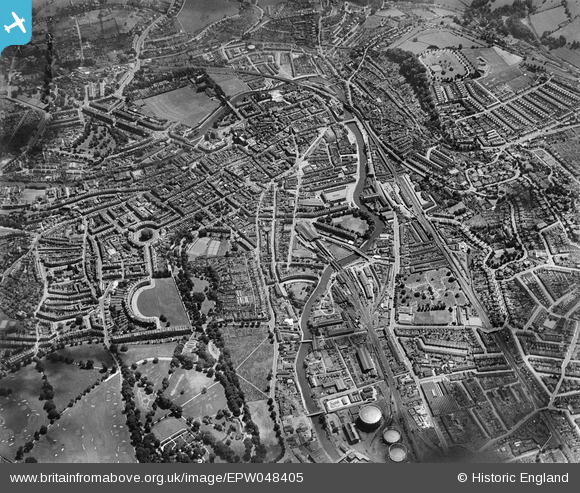
EPW048405 ENGLAND (1935). The city, Bath, from the north-west, 1935
© Hawlfraint cyfranwyr OpenStreetMap a thrwyddedwyd gan yr OpenStreetMap Foundation. 2024. Trwyddedir y gartograffeg fel CC BY-SA.
Delweddau cyfagos (6)
EPW048405

EAW002936

EAW002933

EAW002937

EAW002935

EPW033155

Manylion
| Pennawd | [EPW048405] The city, Bath, from the north-west, 1935 |
| Cyfeirnod | EPW048405 |
| Dyddiad | July-1935 |
| Dolen | |
| Enw lle | BATH |
| Plwyf | |
| Ardal | |
| Gwlad | ENGLAND |
| Dwyreiniad / Gogleddiad | 374060, 165157 |
| Hydred / Lledred | -2.3728004392406, 51.384369139898 |
| Cyfeirnod Grid Cenedlaethol | ST741652 |
Pinnau


Cyfraniadau Grŵp
 Royal Crescent |
 Class31 |
Monday 11th of November 2013 10:10:35 AM |


