
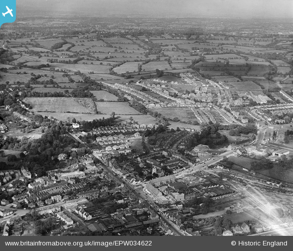
EPW034622 ENGLAND (1930). Housing development to the north of the old village, Edgware, from the south, 1930
© Hawlfraint cyfranwyr OpenStreetMap a thrwyddedwyd gan yr OpenStreetMap Foundation. 2024. Trwyddedir y gartograffeg fel CC BY-SA.
Delweddau cyfagos (18)
EPW034622

EPW034621

EAW020692

EPW015987

EPW016512

EPW049509

EPW034612

EAW027667
 in flight over the Broadfields Avenue area, Edgware, from the south-west, 1949")
EAW020693

EPW005277

EPW016516

EPW015982

EPW009603

EPW005281

EAW048861

EPW034623

EPW015983

EPW009376

Manylion
| Pennawd | [EPW034622] Housing development to the north of the old village, Edgware, from the south, 1930 |
| Cyfeirnod | EPW034622 |
| Dyddiad | 16-October-1930 |
| Dolen | |
| Enw lle | EDGWARE |
| Plwyf | |
| Ardal | |
| Gwlad | ENGLAND |
| Dwyreiniad / Gogleddiad | 519221, 191768 |
| Hydred / Lledred | -0.27799940849501, 51.611632214002 |
| Cyfeirnod Grid Cenedlaethol | TQ192918 |


