
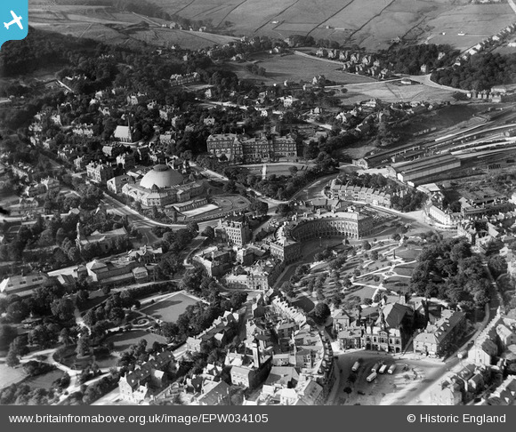
EPW034105 ENGLAND (1930). The town centre including the Devonshire Hospital, The Crescent and the Town Hall, Buxton, 1930
© Hawlfraint cyfranwyr OpenStreetMap a thrwyddedwyd gan yr OpenStreetMap Foundation. 2024. Trwyddedir y gartograffeg fel CC BY-SA.
Delweddau cyfagos (6)
EPW034105

EPW034113

EPW018989

EPW034106

EPW018991

EPW018990

Manylion
| Pennawd | [EPW034105] The town centre including the Devonshire Hospital, The Crescent and the Town Hall, Buxton, 1930 |
| Cyfeirnod | EPW034105 |
| Dyddiad | July-1930 |
| Dolen | |
| Enw lle | BUXTON |
| Plwyf | |
| Ardal | |
| Gwlad | ENGLAND |
| Dwyreiniad / Gogleddiad | 405743, 373641 |
| Hydred / Lledred | -1.9138992463288, 53.259462814473 |
| Cyfeirnod Grid Cenedlaethol | SK057736 |
Pinnau
 Nick Hambleton |
Sunday 26th of July 2015 03:05:45 PM | |
Judy B |
Sunday 1st of March 2015 05:47:23 PM |


