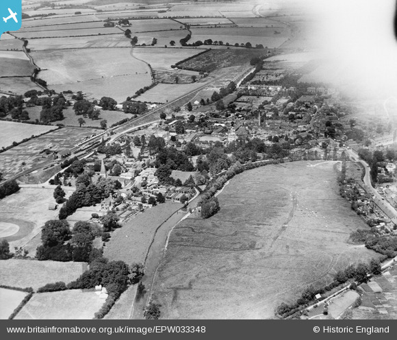
EPW033348 ENGLAND (1930). The town centre and environs, Whitchurch, 1930. This image has been affected by flare.
© Hawlfraint cyfranwyr OpenStreetMap a thrwyddedwyd gan yr OpenStreetMap Foundation. 2024. Trwyddedir y gartograffeg fel CC BY-SA.
Delweddau cyfagos (7)
EPW033348

EPW033350

EPW022733

EPW033346

EPW022731

EPW022729

EPW022730

Manylion
| Pennawd | [EPW033348] The town centre and environs, Whitchurch, 1930. This image has been affected by flare. |
| Cyfeirnod | EPW033348 |
| Dyddiad | July-1930 |
| Dolen | |
| Enw lle | WHITCHURCH |
| Plwyf | WHITCHURCH |
| Ardal | |
| Gwlad | ENGLAND |
| Dwyreiniad / Gogleddiad | 446076, 147857 |
| Hydred / Lledred | -1.3400633607483, 51.227526116182 |
| Cyfeirnod Grid Cenedlaethol | SU461479 |
Pinnau
 Class31 |
Monday 20th of June 2016 11:11:00 PM | |
 clippedwings |
Tuesday 14th of July 2015 09:22:29 PM | |
 flubber |
Saturday 16th of March 2013 12:41:33 AM |