
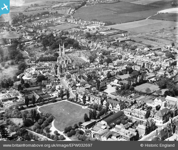
EPW032697 ENGLAND (1930). St Andrew's Church and the town centre, Farnham, 1930
© Hawlfraint cyfranwyr OpenStreetMap a thrwyddedwyd gan yr OpenStreetMap Foundation. 2024. Trwyddedir y gartograffeg fel CC BY-SA.
Delweddau cyfagos (7)
EPW032697

EPW032700

EPW056804

EPW032698

EPW022727

EPW022735

EPW056807

Manylion
| Pennawd | [EPW032697] St Andrew's Church and the town centre, Farnham, 1930 |
| Cyfeirnod | EPW032697 |
| Dyddiad | June-1930 |
| Dolen | |
| Enw lle | FARNHAM |
| Plwyf | FARNHAM |
| Ardal | |
| Gwlad | ENGLAND |
| Dwyreiniad / Gogleddiad | 483968, 146743 |
| Hydred / Lledred | -0.79770463298806, 51.213192457274 |
| Cyfeirnod Grid Cenedlaethol | SU840467 |
Pinnau
 Brian King |
Sunday 6th of February 2022 01:19:58 PM | |
Harlow |
Sunday 2nd of August 2020 08:22:43 PM | |
flubber |
Thursday 15th of August 2013 06:19:45 PM | |
I do not think that it was ever known as a Town Hall but only as the Council Offices. |
Bob Paine |
Saturday 7th of September 2013 05:14:50 PM |
flubber |
Thursday 30th of May 2013 06:43:51 PM | |
flubber |
Thursday 30th of May 2013 06:43:06 PM | |
Bob Paine |
Tuesday 26th of February 2013 12:51:25 PM | |
flubber |
Monday 31st of December 2012 01:57:20 AM |


