
EPW026059 ENGLAND (1929). Charing railway station and environs, Charing, 1929
© Hawlfraint cyfranwyr OpenStreetMap a thrwyddedwyd gan yr OpenStreetMap Foundation. 2024. Trwyddedir y gartograffeg fel CC BY-SA.
Delweddau cyfagos (4)
EPW026059

EPW026056

EPW038122
 and environs, Charing, 1932")
EPW038125

Manylion
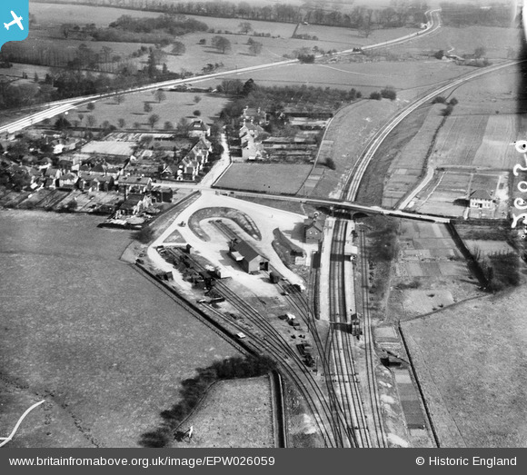
| Pennawd | [EPW026059] Charing railway station and environs, Charing, 1929 |
| Cyfeirnod | EPW026059 |
| Dyddiad | April-1929 |
| Dolen | |
| Enw lle | CHARING |
| Plwyf | CHARING |
| Ardal | |
| Gwlad | ENGLAND |
| Dwyreiniad / Gogleddiad | 595027, 149152 |
| Hydred / Lledred | 0.79235452300694, 51.207709681109 |
| Cyfeirnod Grid Cenedlaethol | TQ950492 |
Pinnau
 Billy Turner |
Monday 18th of January 2016 03:05:12 PM | |
 MB |
Friday 26th of October 2012 12:48:03 PM | |
MB |
Friday 26th of October 2012 12:47:35 PM | |
MB |
Friday 26th of October 2012 12:42:03 PM | |
MB |
Friday 26th of October 2012 12:40:43 PM | |
Southern By-pass. There was also a Northern By-pass |
MB |
Friday 26th of October 2012 12:43:39 PM |
MB |
Friday 26th of October 2012 12:39:34 PM | |
MB |
Friday 26th of October 2012 12:38:16 PM | |
MB |
Friday 26th of October 2012 12:37:15 PM | |
MB |
Friday 26th of October 2012 12:36:52 PM | |
MB |
Friday 26th of October 2012 12:33:49 PM | |
MB |
Friday 26th of October 2012 12:33:29 PM | |
MB |
Friday 26th of October 2012 12:32:59 PM |


