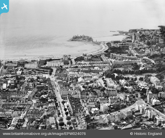
EPW024076 ENGLAND (1928). The town centre, Weston-super-Mare, from the east, 1928
© Hawlfraint cyfranwyr OpenStreetMap a thrwyddedwyd gan yr OpenStreetMap Foundation. 2024. Trwyddedir y gartograffeg fel CC BY-SA.
Delweddau cyfagos (2)
EPW024076

EAW025151

Manylion
| Pennawd | [EPW024076] The town centre, Weston-super-Mare, from the east, 1928 |
| Cyfeirnod | EPW024076 |
| Dyddiad | September-1928 |
| Dolen | |
| Enw lle | WESTON-SUPER-MARE |
| Plwyf | WESTON-SUPER-MARE |
| Ardal | |
| Gwlad | ENGLAND |
| Dwyreiniad / Gogleddiad | 332058, 161743 |
| Hydred / Lledred | -2.9757205589763, 51.350197877791 |
| Cyfeirnod Grid Cenedlaethol | ST321617 |
Pinnau
 Gen_Hancock |
Friday 3rd of February 2017 01:58:19 PM | |
 Alan McFaden |
Saturday 19th of October 2013 12:46:00 PM | |
Alan McFaden |
Saturday 19th of October 2013 12:45:03 PM | |
MB |
Monday 10th of September 2012 10:15:26 PM | |
MB |
Monday 10th of September 2012 10:14:54 PM | |
MB |
Monday 10th of September 2012 10:14:20 PM | |
MB |
Monday 10th of September 2012 10:09:39 PM | |
MB |
Monday 10th of September 2012 10:08:47 PM | |
MB |
Monday 10th of September 2012 10:07:38 PM | |
MB |
Monday 10th of September 2012 10:07:07 PM | |
MB |
Monday 10th of September 2012 10:05:04 PM | |
MB |
Monday 10th of September 2012 10:03:27 PM | |
MB |
Monday 10th of September 2012 10:02:12 PM |