
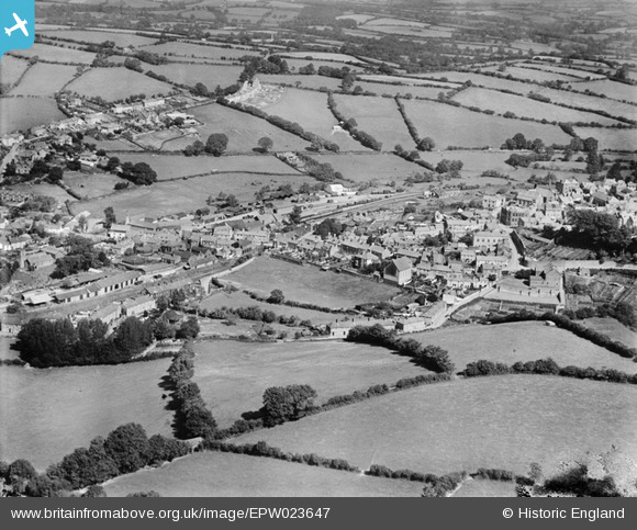
EPW023647 ENGLAND (1928). St Thomas, Launceston, 1928
© Hawlfraint cyfranwyr OpenStreetMap a thrwyddedwyd gan yr OpenStreetMap Foundation. 2024. Trwyddedir y gartograffeg fel CC BY-SA.
Delweddau cyfagos (4)
EPW023647

EPW054780

EPW023644

EAW014991

Manylion
| Pennawd | [EPW023647] St Thomas, Launceston, 1928 |
| Cyfeirnod | EPW023647 |
| Dyddiad | September-1928 |
| Dolen | |
| Enw lle | LAUNCESTON |
| Plwyf | LAUNCESTON |
| Ardal | |
| Gwlad | ENGLAND |
| Dwyreiniad / Gogleddiad | 232936, 84941 |
| Hydred / Lledred | -4.3629610627292, 50.639598652667 |
| Cyfeirnod Grid Cenedlaethol | SX329849 |
Pinnau
 Class31 |
Saturday 1st of December 2012 05:59:03 AM | |
Class31 |
Saturday 1st of December 2012 05:58:21 AM | |
Class31 |
Saturday 1st of December 2012 05:54:04 AM | |
Class31 |
Saturday 1st of December 2012 05:51:52 AM | |
Class31 |
Saturday 1st of December 2012 05:50:51 AM | |
 MB |
Monday 3rd of September 2012 10:25:12 AM | |
MB |
Monday 3rd of September 2012 10:22:30 AM | |
Nowy Paul |
Tuesday 21st of August 2012 08:38:40 PM | |
Nowy Paul |
Tuesday 21st of August 2012 08:31:59 PM | |
This Station was a through station. |
Nowy Paul |
Tuesday 21st of August 2012 08:46:17 PM |
Nowy Paul |
Tuesday 21st of August 2012 08:31:09 PM | |
This station was a terminus. |
Nowy Paul |
Tuesday 21st of August 2012 08:46:57 PM |


