
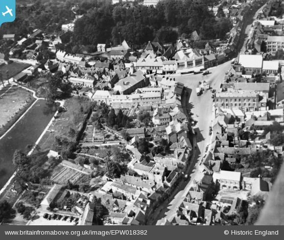
EPW018382 ENGLAND (1927). High Street and The Broadway, Chesham, 1927. This image has been produced from a copy-negative.
© Hawlfraint cyfranwyr OpenStreetMap a thrwyddedwyd gan yr OpenStreetMap Foundation. 2024. Trwyddedir y gartograffeg fel CC BY-SA.
Delweddau cyfagos (8)
EPW018382

EPW018387

EPW018385

EPW018379

EPW018384

EAW003135

EPW018381

EPW021326

Manylion
| Pennawd | [EPW018382] High Street and The Broadway, Chesham, 1927. This image has been produced from a copy-negative. |
| Cyfeirnod | EPW018382 |
| Dyddiad | June-1927 |
| Dolen | |
| Enw lle | CHESHAM |
| Plwyf | CHESHAM |
| Ardal | |
| Gwlad | ENGLAND |
| Dwyreiniad / Gogleddiad | 495942, 201691 |
| Hydred / Lledred | -0.61139270804004, 51.705285891294 |
| Cyfeirnod Grid Cenedlaethol | SP959017 |
Pinnau
 totoro |
Thursday 27th of November 2014 09:32:15 PM | |
totoro |
Thursday 27th of November 2014 09:30:54 PM |


