
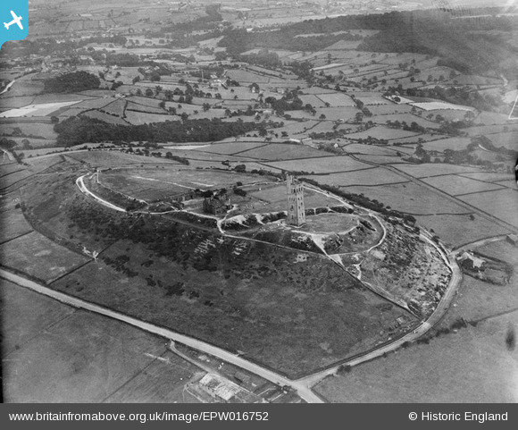
EPW016752 ENGLAND (1926). Castle Hill, Huddersfield, 1926
© Hawlfraint cyfranwyr OpenStreetMap a thrwyddedwyd gan yr OpenStreetMap Foundation. 2024. Trwyddedir y gartograffeg fel CC BY-SA.
Delweddau cyfagos (3)
EPW016752

EPW016753

EPW016751

Manylion
| Pennawd | [EPW016752] Castle Hill, Huddersfield, 1926 |
| Cyfeirnod | EPW016752 |
| Dyddiad | August-1926 |
| Dolen | |
| Enw lle | HUDDERSFIELD |
| Plwyf | |
| Ardal | |
| Gwlad | ENGLAND |
| Dwyreiniad / Gogleddiad | 415232, 414032 |
| Hydred / Lledred | -1.7696829713256, 53.622369266012 |
| Cyfeirnod Grid Cenedlaethol | SE152140 |
Pinnau
 RoyPlum |
Monday 30th of November 2020 03:40:04 PM | |
RoyPlum |
Monday 30th of November 2020 03:35:15 PM | |
RoyPlum |
Monday 30th of November 2020 03:32:14 PM | |
RoyPlum |
Monday 30th of November 2020 03:31:01 PM | |
RoyPlum |
Monday 30th of November 2020 03:29:24 PM | |
RoyPlum |
Monday 30th of November 2020 03:28:24 PM | |
RoyPlum |
Monday 30th of November 2020 03:27:58 PM | |
RoyPlum |
Monday 30th of November 2020 03:26:16 PM | |
RoyPlum |
Monday 30th of November 2020 03:23:56 PM | |
RoyPlum |
Monday 30th of November 2020 03:20:16 PM | |
RoyPlum |
Monday 30th of November 2020 03:16:50 PM |
Cyfraniadau Grŵp
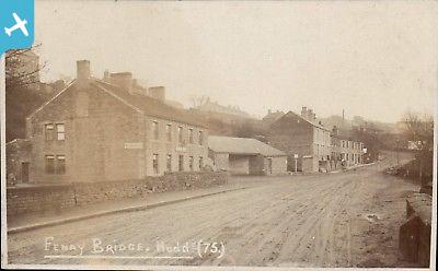
The area with the house on the right of the picture is called Ogley, the house had a barn attached to it and was used as a Dye house for dyeing wool from the handloom weavers. |
Rover45 |
Saturday 30th of June 2012 06:02:57 PM |


