
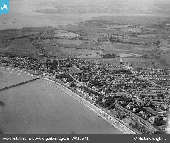
EPW016541 ENGLAND (1926). View of the west of town towards the port, Felixstowe, from the east, 1926
© Hawlfraint cyfranwyr OpenStreetMap a thrwyddedwyd gan yr OpenStreetMap Foundation. 2024. Trwyddedir y gartograffeg fel CC BY-SA.
Delweddau cyfagos (7)
EPW016541

EAW038358

EAW038360

EPW001917

EPW039283

EPW039279

EAW024310

Manylion
| Pennawd | [EPW016541] View of the west of town towards the port, Felixstowe, from the east, 1926 |
| Cyfeirnod | EPW016541 |
| Dyddiad | August-1926 |
| Dolen | |
| Enw lle | FELIXSTOWE |
| Plwyf | FELIXSTOWE |
| Ardal | |
| Gwlad | ENGLAND |
| Dwyreiniad / Gogleddiad | 630278, 234337 |
| Hydred / Lledred | 1.3520945824849, 51.959315193894 |
| Cyfeirnod Grid Cenedlaethol | TM303343 |
-in-1960-A4-Photo.jpg?itok=hjX3nbuV)


