
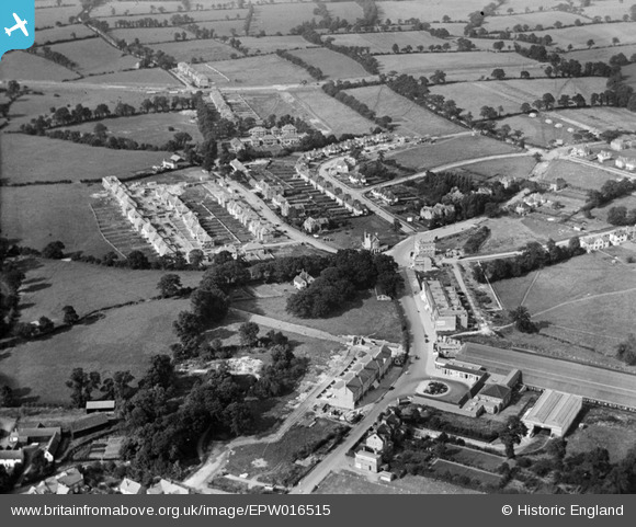
EPW016515 ENGLAND (1926). The underground station and housing around Edgwarebury Lane, Edgware, 1926
© Hawlfraint cyfranwyr OpenStreetMap a thrwyddedwyd gan yr OpenStreetMap Foundation. 2024. Trwyddedir y gartograffeg fel CC BY-SA.
Delweddau cyfagos (10)
EPW016515

EPW034553

EPW015985

EPW031552

EPW031555

EPW034618

EPW009373

EPW031553

EPW016513

EPW034612

Manylion
| Pennawd | [EPW016515] The underground station and housing around Edgwarebury Lane, Edgware, 1926 |
| Cyfeirnod | EPW016515 |
| Dyddiad | 25-August-1926 |
| Dolen | |
| Enw lle | EDGWARE |
| Plwyf | |
| Ardal | |
| Gwlad | ENGLAND |
| Dwyreiniad / Gogleddiad | 519424, 192198 |
| Hydred / Lledred | -0.27492220440703, 51.615454130239 |
| Cyfeirnod Grid Cenedlaethol | TQ194922 |
Pinnau
 Andrew Moss |
Thursday 4th of April 2024 06:17:10 PM | |
Andrew Moss |
Thursday 4th of April 2024 06:15:50 PM | |
Andrew Moss |
Thursday 4th of April 2024 06:12:50 PM | |
Spaceweed |
Thursday 8th of September 2022 01:44:00 AM | |
Drdub |
Sunday 13th of June 2021 05:08:29 PM | |
Digitalsnapper |
Monday 2nd of January 2017 02:41:07 PM | |
Digitalsnapper |
Monday 2nd of January 2017 02:39:48 PM | |
Digitalsnapper |
Monday 2nd of January 2017 02:39:43 PM |


