
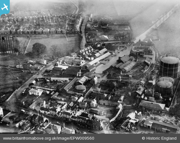
EPW009560 ENGLAND (1923). Timber yards and wharves beside Chelmsford Corporation Gas Works, Chelmsford, 1923. This image has been produced from a copy-negative.
© Hawlfraint cyfranwyr OpenStreetMap a thrwyddedwyd gan yr OpenStreetMap Foundation. 2024. Trwyddedir y gartograffeg fel CC BY-SA.
Delweddau cyfagos (22)
EPW009560

EPW009554

EPW046412

EPW046415

EPW046411

EPW046419

EPW046414

EPW046410

EPW016553

EPW016553
EPW046420

EPW046450

EPW046453

EPW046452

EPW046454

EPW046451

EPW046449

EPW046417

EPW046413

EPW046418

EPW058735

EPW046416

Manylion
| Pennawd | [EPW009560] Timber yards and wharves beside Chelmsford Corporation Gas Works, Chelmsford, 1923. This image has been produced from a copy-negative. |
| Cyfeirnod | EPW009560 |
| Dyddiad | 1923 |
| Dolen | |
| Enw lle | CHELMSFORD |
| Plwyf | |
| Ardal | |
| Gwlad | ENGLAND |
| Dwyreiniad / Gogleddiad | 571366, 206680 |
| Hydred / Lledred | 0.48184310352811, 51.732143372607 |
| Cyfeirnod Grid Cenedlaethol | TL714067 |
Pinnau
 Ian |
Monday 13th of October 2014 09:17:09 PM | |
Ian |
Monday 13th of October 2014 09:15:40 PM | |
Ian |
Monday 13th of October 2014 09:14:51 PM | |
Ian |
Monday 13th of October 2014 09:13:11 PM | |
Ian |
Monday 13th of October 2014 09:12:14 PM | |
Ian |
Monday 13th of October 2014 09:11:27 PM | |
Ian |
Monday 13th of October 2014 09:09:59 PM | |
Ian |
Monday 13th of October 2014 09:09:04 PM |


