
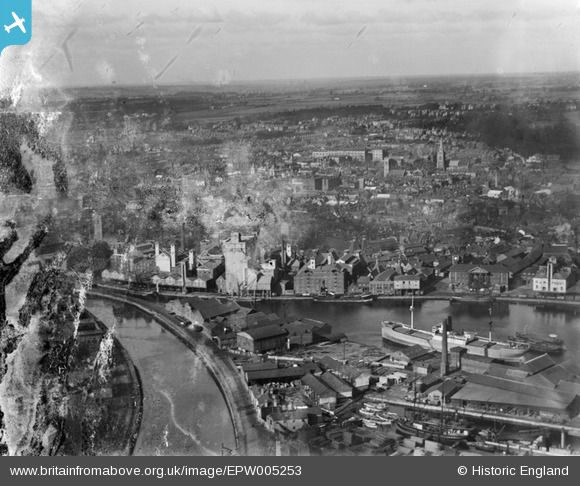
EPW005253 ENGLAND (1921). Ipswich and the Common Quay, Ipswich, from the south, 1921
© Hawlfraint cyfranwyr OpenStreetMap a thrwyddedwyd gan yr OpenStreetMap Foundation. 2024. Trwyddedir y gartograffeg fel CC BY-SA.
Delweddau cyfagos (19)
EPW005253

EPW058767
 Ltd timber works, Three Cranes Wharf and New Cut East, Ipswich, 1938")
EPW058766
 Ltd timber works, Three Cranes Wharf and environs, Ipswich, 1938")
EPW058765
 Ltd timber works, Wet Dock and environs, Ipswich, 1938")
EPW032856

EPW058768
 Ltd timber works, Wet Dock and environs, Ipswich, 1938")
EPW058764
 Ltd timber works, Wet Dock and environs, Ipswich, 1938")
EPW058769
 Ltd timber works, Three Cranes Wharf and environs, Ipswich, 1938")
EPW032845

EPW032832

EAW033332

EPW058747

EPW049173

EAW033334

EAW053511

EPW032837

EPW032859

EPW032836

EPW032877

Manylion
| Pennawd | [EPW005253] Ipswich and the Common Quay, Ipswich, from the south, 1921 |
| Cyfeirnod | EPW005253 |
| Dyddiad | January-1921 |
| Dolen | |
| Enw lle | IPSWICH |
| Plwyf | |
| Ardal | |
| Gwlad | ENGLAND |
| Dwyreiniad / Gogleddiad | 616687, 243871 |
| Hydred / Lledred | 1.1606185590749, 52.050374416337 |
| Cyfeirnod Grid Cenedlaethol | TM167439 |


