
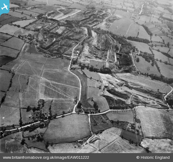
EAW011222 ENGLAND (1947). Denby Lane, Dumbles Lane and opencast coal mining to the east of Flamstead House, Denby Village, 1947
© Hawlfraint cyfranwyr OpenStreetMap a thrwyddedwyd gan yr OpenStreetMap Foundation. 2024. Trwyddedir y gartograffeg fel CC BY-SA.
Delweddau cyfagos (2)
EAW011222

EAW011245

Manylion
| Pennawd | [EAW011222] Denby Lane, Dumbles Lane and opencast coal mining to the east of Flamstead House, Denby Village, 1947 |
| Cyfeirnod | EAW011222 |
| Dyddiad | 30-September-1947 |
| Dolen | |
| Enw lle | DENBY VILLAGE |
| Plwyf | DENBY |
| Ardal | |
| Gwlad | ENGLAND |
| Dwyreiniad / Gogleddiad | 440851, 346652 |
| Hydred / Lledred | -1.3910092078188, 53.015303471843 |
| Cyfeirnod Grid Cenedlaethol | SK409467 |


