
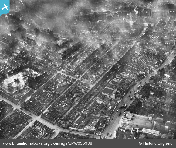
EPW055988 ENGLAND (1937). Skidmore Street and environs, Mile End, 1937
© Copyright OpenStreetMap contributors and licensed by the OpenStreetMap Foundation. 2024. Cartography is licensed as CC BY-SA.
Nearby Images (4)
EPW055988

EPW055990

EPW055989

EPW055991

Details
| Title | [EPW055988] Skidmore Street and environs, Mile End, 1937 |
| Reference | EPW055988 |
| Date | 9-November-1937 |
| Link | |
| Place name | MILE END |
| Parish | |
| District | |
| Country | ENGLAND |
| Easting / Northing | 535931, 182064 |
| Longitude / Latitude | -0.040540758987967, 51.520634103839 |
| National Grid Reference | TQ359821 |
Pins
 Carlont |
Saturday 25th of September 2021 04:26:11 PM | |
MandrakeMan |
Thursday 6th of June 2019 02:55:25 PM | |
povetski |
Wednesday 12th of December 2018 08:34:19 PM | |
 Class31 |
Tuesday 28th of April 2015 08:41:33 AM | |
Class31 |
Tuesday 28th of April 2015 08:40:52 AM | |
Class31 |
Tuesday 28th of April 2015 08:39:24 AM | |
Class31 |
Tuesday 28th of April 2015 08:37:30 AM | |
Class31 |
Tuesday 28th of April 2015 08:37:10 AM |


User Comment Contributions
We are looking south west. |
Class31 |
Tuesday 28th of April 2015 08:39:55 AM |


