
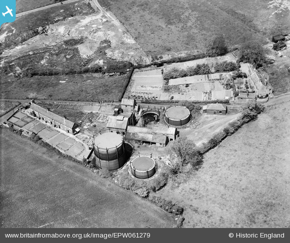
epw061279 ENGLAND (1939). The town Gas Works, Dawley, 1939
© Copyright OpenStreetMap contributors and licensed by the OpenStreetMap Foundation. 2024. Cartography is licensed as CC BY-SA.
Nearby Images (5)
EPW061279

EPW061278

EPW061275

EPW061276

EPW061277

Details
| Title | [EPW061279] The town Gas Works, Dawley, 1939 |
| Reference | EPW061279 |
| Date | 31-May-1939 |
| Link | |
| Place name | DAWLEY |
| Parish | GREAT DAWLEY |
| District | |
| Country | ENGLAND |
| Easting / Northing | 368234, 307098 |
| Longitude / Latitude | -2.4697085946057, 52.660323093564 |
| National Grid Reference | SJ682071 |
Pins
Be the first to add a comment to this image!


