
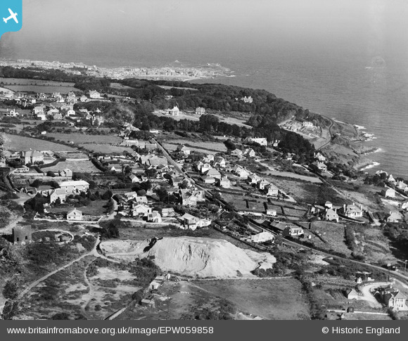
epw059858 ENGLAND (1938). Chy an Gweal looking towards St Ives Head, St Ives, from the south, 1938
© Copyright OpenStreetMap contributors and licensed by the OpenStreetMap Foundation. 2025. Cartography is licensed as CC BY-SA.
Details
| Title | [EPW059858] Chy an Gweal looking towards St Ives Head, St Ives, from the south, 1938 |
| Reference | EPW059858 |
| Date | 22-September-1938 |
| Link | |
| Place name | ST IVES |
| Parish | ST. IVES |
| District | |
| Country | ENGLAND |
| Easting / Northing | 152335, 38711 |
| Longitude / Latitude | -5.470605051921, 50.19590241921 |
| National Grid Reference | SW523387 |
Pins
User Comment Contributions
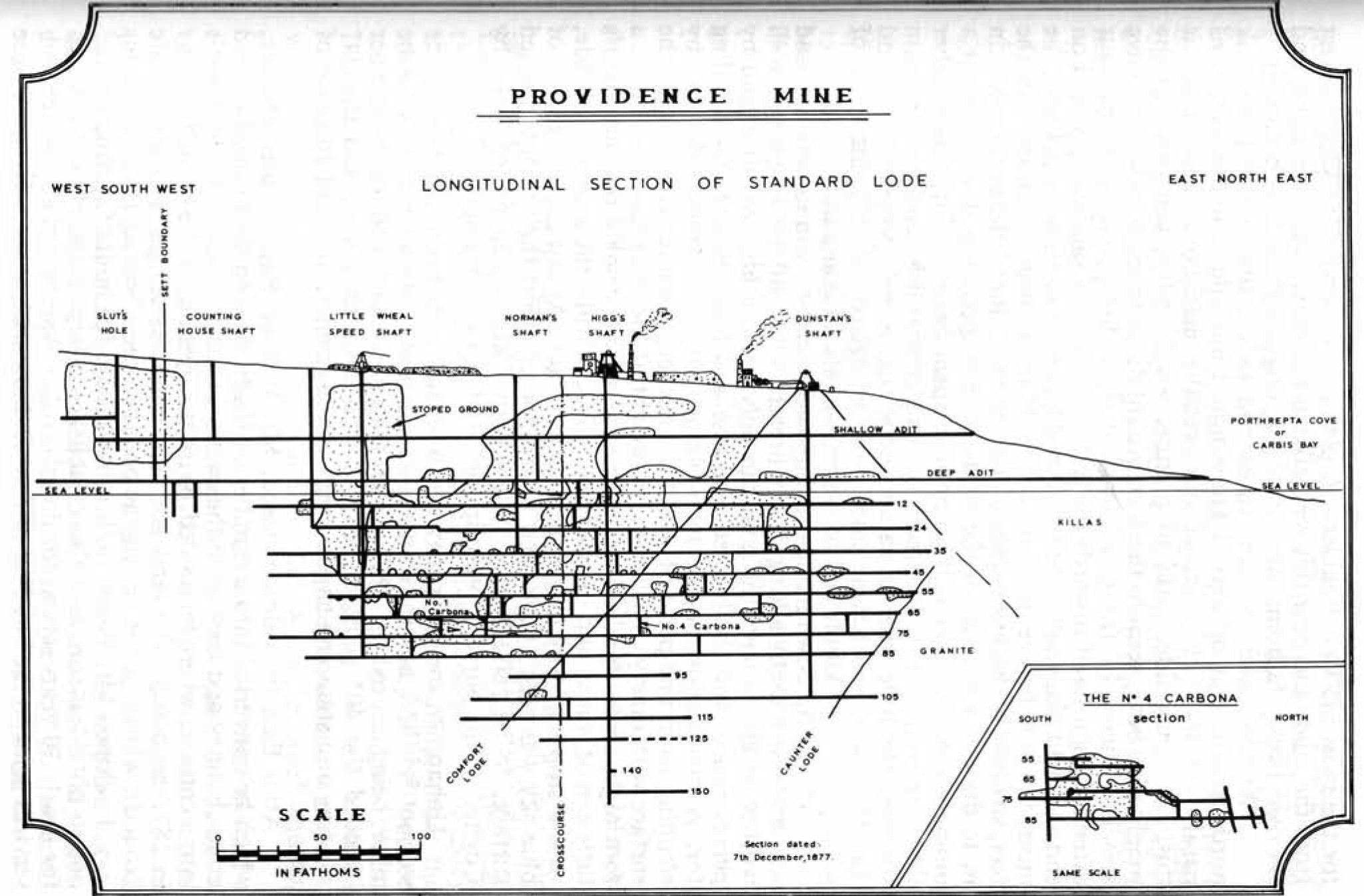 The large white mound is providence mine waste dump. You can just make out Higgs Engine House remains to the left of the picture. The waste dump is built over and now called White House Close, Carbis bay. Bungalows are built right over the adits and shafts in that area. No building regs back in the 60's it seems! 200 years of rotting timbers hold up the backfilled land, surely its just a matter of time before the whole estate starts sinking into the voids below. Anyone considering buying a property in that area MUST have it drilled to determine what voids are beneath. A friend of mine recently tried to get a mortgage on a property in White House Close Carbis Bay .... due to the heavily worked land in that area no one was prepared to lend. |
 andy308 |
Tuesday 7th of October 2014 03:22:34 PM |