
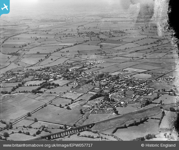
epw057717 ENGLAND (1938). The Brackley Viaduct and the town, Brackley, from the east, 1938. This image has been produced from a damaged negative.
© Copyright OpenStreetMap contributors and licensed by the OpenStreetMap Foundation. 2026. Cartography is licensed as CC BY-SA.
Details
| Title | [EPW057717] The Brackley Viaduct and the town, Brackley, from the east, 1938. This image has been produced from a damaged negative. |
| Reference | EPW057717 |
| Date | 21-June-1938 |
| Link | |
| Place name | BRACKLEY |
| Parish | BRACKLEY |
| District | |
| Country | ENGLAND |
| Easting / Northing | 459023, 237218 |
| Longitude / Latitude | -1.1395778663808, 52.029806505728 |
| National Grid Reference | SP590372 |
Pins

John Wass |
Wednesday 13th of May 2015 09:24:41 PM | |
|
John Wass |
Wednesday 13th of May 2015 09:23:49 PM | |
|
Kevin Timms |
Thursday 24th of July 2014 01:19:31 PM |