
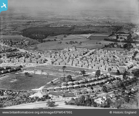
epw047991 ENGLAND (1935). The Woodthorpe Estate, Sheffield, from the south, 1935
© Copyright OpenStreetMap contributors and licensed by the OpenStreetMap Foundation. 2025. Cartography is licensed as CC BY-SA.
Details
| Title | [EPW047991] The Woodthorpe Estate, Sheffield, from the south, 1935 |
| Reference | EPW047991 |
| Date | June-1935 |
| Link | |
| Place name | SHEFFIELD |
| Parish | |
| District | |
| Country | ENGLAND |
| Easting / Northing | 439184, 385059 |
| Longitude / Latitude | -1.4111477656914, 53.360686360528 |
| National Grid Reference | SK392851 |
Pins

Railway Man |
Tuesday 9th of July 2019 03:33:56 PM | |
|
Railway Man |
Tuesday 9th of July 2019 03:32:25 PM | |
|
greenlandbusman |
Sunday 27th of April 2014 09:58:38 PM |