
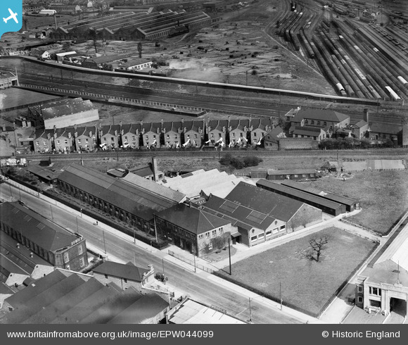
epw044099 ENGLAND (1934). The George Philip and Son Geographical Institute, North Acton, 1934
© Copyright OpenStreetMap contributors and licensed by the OpenStreetMap Foundation. 2025. Cartography is licensed as CC BY-SA.
Nearby Images (25)
EPW044099

EPW044100

EPW005214

EPW005185

EPW044097

EPW044098

EPW005172

EPW005211

EPW005173

EPW005213

EPW005174

EPW005171

EPW005210

EPW005212

EPW058336

EPW005183

EPW005170

EAW033527

EPW005169

EAW009102

EPW034968

EPW034968
EPW034966

EPW054162

EPW054157

Details
| Title | [EPW044099] The George Philip and Son Geographical Institute, North Acton, 1934 |
| Reference | EPW044099 |
| Date | April-1934 |
| Link | |
| Place name | NORTH ACTON |
| Parish | |
| District | |
| Country | ENGLAND |
| Easting / Northing | 521225, 182202 |
| Longitude / Latitude | -0.25236923628876, 51.525223003596 |
| National Grid Reference | TQ212822 |
Pins
Be the first to add a comment to this image!