
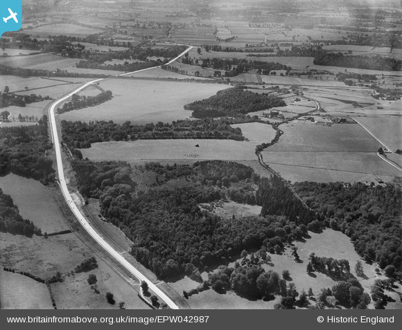
epw042987 ENGLAND (1933). A recently constructed section of the A412 (North Orbital Road) beside the site of Denham Garden Village, Denham Green, 1933
© Copyright OpenStreetMap contributors and licensed by the OpenStreetMap Foundation. 2025. Cartography is licensed as CC BY-SA.
Details
| Title | [EPW042987] A recently constructed section of the A412 (North Orbital Road) beside the site of Denham Garden Village, Denham Green, 1933 |
| Reference | EPW042987 |
| Date | September-1933 |
| Link | |
| Place name | DENHAM GREEN |
| Parish | DENHAM |
| District | |
| Country | ENGLAND |
| Easting / Northing | 503617, 188981 |
| Longitude / Latitude | -0.50411454154822, 51.589668007733 |
| National Grid Reference | TQ036890 |
Pins

tads |
Friday 6th of February 2015 07:26:39 PM | |
|
moses72 |
Friday 18th of October 2013 11:30:19 AM | |
|
moses72 |
Friday 18th of October 2013 11:29:03 AM | |
|
moses72 |
Friday 18th of October 2013 11:27:06 AM | |
|
moses72 |
Friday 18th of October 2013 11:25:32 AM | |
|
moses72 |
Friday 18th of October 2013 11:13:15 AM | |
|
moses72 |
Friday 18th of October 2013 11:11:19 AM | |
|
moses72 |
Friday 18th of October 2013 11:09:34 AM | |
|
moses72 |
Friday 18th of October 2013 11:06:16 AM | |
|
moses72 |
Friday 18th of October 2013 11:04:29 AM | |
|
moses72 |
Friday 18th of October 2013 11:01:42 AM | |
|
moses72 |
Friday 18th of October 2013 10:59:35 AM | |
|
moses72 |
Friday 18th of October 2013 10:55:19 AM | |
|
moses72 |
Friday 18th of October 2013 10:53:13 AM |