
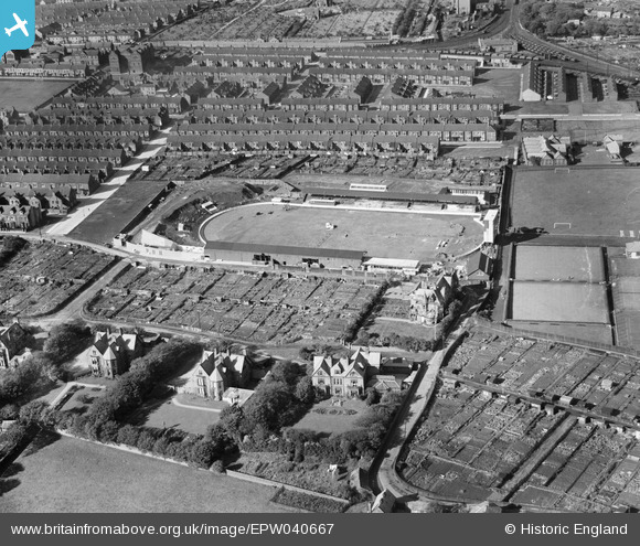
epw040667 ENGLAND (1932). South Shields Stadium, South Shields, 1932
© Copyright OpenStreetMap contributors and licensed by the OpenStreetMap Foundation. 2026. Cartography is licensed as CC BY-SA.
Nearby Images (2)
EPW040667

EPW040668

Details
| Title | [EPW040667] South Shields Stadium, South Shields, 1932 |
| Reference | EPW040667 |
| Date | October-1932 |
| Link | |
| Place name | SOUTH SHIELDS |
| Parish | |
| District | |
| Country | ENGLAND |
| Easting / Northing | 437483, 566248 |
| Longitude / Latitude | -1.4141352414581, 54.989335974297 |
| National Grid Reference | NZ375662 |
Pins

Bluesboy |
Sunday 6th of July 2014 12:44:26 AM | |
|
Bluesboy |
Saturday 5th of July 2014 09:42:13 PM | |
|
gerry-r |
Monday 16th of June 2014 12:35:44 AM |