
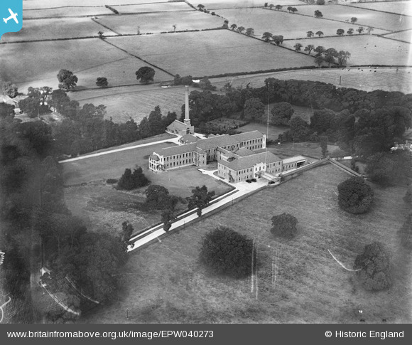
epw040273 ENGLAND (1932). Hull Royal Infirmary - Sutton (Princess Royal Infirmary), Sutton Ings, 1932
© Copyright OpenStreetMap contributors and licensed by the OpenStreetMap Foundation. 2026. Cartography is licensed as CC BY-SA.
Details
| Title | [EPW040273] Hull Royal Infirmary - Sutton (Princess Royal Infirmary), Sutton Ings, 1932 |
| Reference | EPW040273 |
| Date | September-1932 |
| Link | |
| Place name | SUTTON INGS |
| Parish | |
| District | |
| Country | ENGLAND |
| Easting / Northing | 513449, 432574 |
| Longitude / Latitude | -0.27821086144122, 53.776904774955 |
| National Grid Reference | TA134326 |
Pins

John Wass |
Saturday 1st of August 2015 08:53:44 PM |
User Comment Contributions
Always known locally as 'Sutton Annexe' until long after WWII |
Russell |
Tuesday 12th of May 2015 05:01:47 PM |