
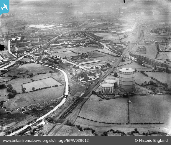
epw039612 ENGLAND (1932). Coventry Corporation Gas Works and environs, Longford, 1932
© Copyright OpenStreetMap contributors and licensed by the OpenStreetMap Foundation. 2024. Cartography is licensed as CC BY-SA.
Nearby Images (11)
EPW039612

EPW039609

EPW039608

EAW001836

EAW001839

EAW001842

EAW001837

EAW001838

EAW001841

EAW001840

EPW027271

Details
| Title | [EPW039612] Coventry Corporation Gas Works and environs, Longford, 1932 |
| Reference | EPW039612 |
| Date | August-1932 |
| Link | |
| Place name | LONGFORD |
| Parish | |
| District | |
| Country | ENGLAND |
| Easting / Northing | 434536, 283258 |
| Longitude / Latitude | -1.491816638854, 52.445819203498 |
| National Grid Reference | SP345833 |
Pins
 Derrickarthur |
Wednesday 19th of March 2014 11:00:13 PM | |
Tezzacov |
Sunday 9th of June 2013 08:00:20 AM | |
Tezzacov |
Sunday 9th of June 2013 07:59:36 AM | |
Tezzacov |
Sunday 9th of June 2013 07:58:47 AM | |
Tezzacov |
Sunday 9th of June 2013 07:57:19 AM | |
Tezzacov |
Sunday 9th of June 2013 07:53:46 AM | |
Tezzacov |
Sunday 9th of June 2013 07:49:42 AM | |
Tezzacov |
Sunday 9th of June 2013 07:47:31 AM | |
Tezzacov |
Sunday 9th of June 2013 07:46:44 AM | |
Tezzacov |
Sunday 9th of June 2013 07:45:52 AM | |
JG |
Sunday 12th of May 2013 11:37:26 PM |


