
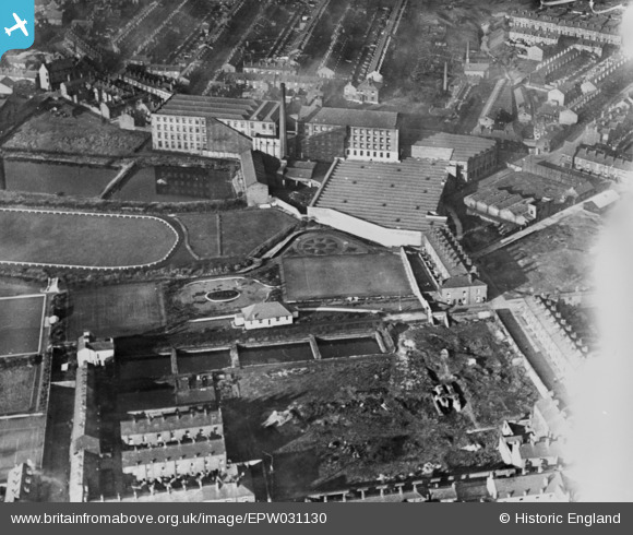
epw031130 ENGLAND (1929). Atherton Cotton Mill and adjacent recreation ground, Tyldesley, 1929. This image has been produced from a copy-negative.
© Copyright OpenStreetMap contributors and licensed by the OpenStreetMap Foundation. 2025. Cartography is licensed as CC BY-SA.
Details
| Title | [EPW031130] Atherton Cotton Mill and adjacent recreation ground, Tyldesley, 1929. This image has been produced from a copy-negative. |
| Reference | EPW031130 |
| Date | October-1929 |
| Link | |
| Place name | TYLDESLEY |
| Parish | |
| District | |
| Country | ENGLAND |
| Easting / Northing | 368581, 402136 |
| Longitude / Latitude | -2.4738704745446, 53.514714375345 |
| National Grid Reference | SD686021 |
Pins

SMJ |
Wednesday 12th of November 2014 12:33:21 PM | |
|
SMJ |
Wednesday 12th of November 2014 12:32:27 PM | |
|
SMJ |
Wednesday 12th of November 2014 12:31:57 PM | |
|
SMJ |
Wednesday 12th of November 2014 12:31:34 PM | |
|
SMJ |
Wednesday 12th of November 2014 12:30:51 PM | |
|
SMJ |
Wednesday 12th of November 2014 12:30:04 PM | |
|
SMJ |
Wednesday 12th of November 2014 12:29:14 PM | |
|
SMJ |
Wednesday 12th of November 2014 12:28:20 PM | |
|
SMJ |
Wednesday 12th of November 2014 12:27:58 PM | |
|
SMJ |
Wednesday 12th of November 2014 12:27:25 PM | |
|
SMJ |
Wednesday 12th of November 2014 12:26:41 PM | |
|
SMJ |
Wednesday 12th of November 2014 12:26:00 PM | |
|
SMJ |
Wednesday 12th of November 2014 11:05:04 AM | |
|
SMJ |
Wednesday 12th of November 2014 11:04:24 AM | |
|
SMJ |
Wednesday 12th of November 2014 11:03:52 AM |