
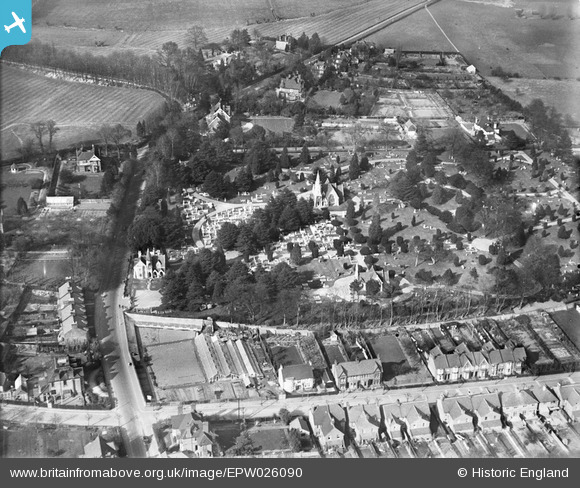
epw026090 ENGLAND (1929). Canterbury Road Cemetery and Gore Hill, Ashford, 1929
© Copyright OpenStreetMap contributors and licensed by the OpenStreetMap Foundation. 2026. Cartography is licensed as CC BY-SA.
Details
| Title | [EPW026090] Canterbury Road Cemetery and Gore Hill, Ashford, 1929 |
| Reference | EPW026090 |
| Date | 19-April-1929 |
| Link | |
| Place name | ASHFORD |
| Parish | |
| District | |
| Country | ENGLAND |
| Easting / Northing | 601156, 143302 |
| Longitude / Latitude | 0.8767165037221, 51.153041418459 |
| National Grid Reference | TR012433 |
Pins
Be the first to add a comment to this image!