
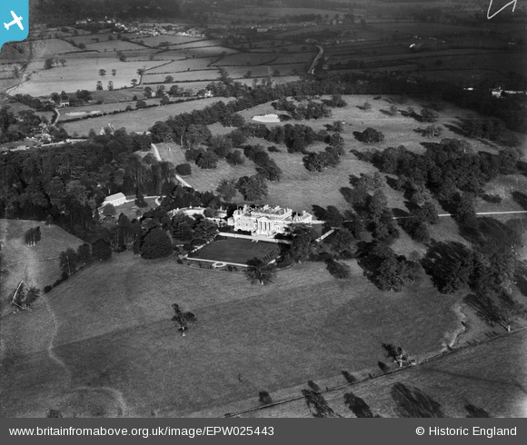
epw025443 ENGLAND (1928). Wrotham Park, Wrotham Park, 1928
© Copyright OpenStreetMap contributors and licensed by the OpenStreetMap Foundation. 2025. Cartography is licensed as CC BY-SA.
Nearby Images (3)
EPW025443

EPW059321

EPW025442

Details
| Title | [EPW025443] Wrotham Park, Wrotham Park, 1928 |
| Reference | EPW025443 |
| Date | November-1928 |
| Link | |
| Place name | WROTHAM PARK |
| Parish | |
| District | |
| Country | ENGLAND |
| Easting / Northing | 524788, 199159 |
| Longitude / Latitude | -0.19499620153396, 51.676854632147 |
| National Grid Reference | TQ248992 |
Pins
Be the first to add a comment to this image!