
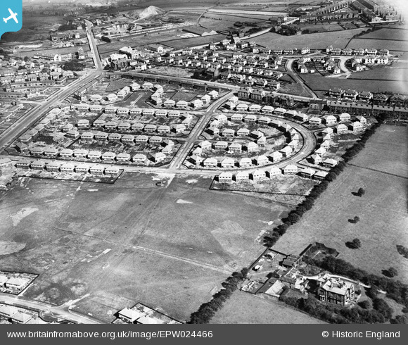
epw024466 ENGLAND (1928). Swain House, Eccleshill, 1928.
© Copyright OpenStreetMap contributors and licensed by the OpenStreetMap Foundation. 2026. Cartography is licensed as CC BY-SA.
Nearby Images (2)
EPW024466

EPW024467

Details
| Title | [EPW024466] Swain House, Eccleshill, 1928. |
| Reference | EPW024466 |
| Date | September-1928 |
| Link | |
| Place name | ECCLESHILL |
| Parish | |
| District | |
| Country | ENGLAND |
| Easting / Northing | 417266, 436038 |
| Longitude / Latitude | -1.7376999967246, 53.820118836883 |
| National Grid Reference | SE173360 |
Pins

david |
Thursday 18th of September 2025 07:17:18 PM | |
|
John N |
Sunday 25th of October 2020 12:22:54 AM | |
|
Michaela |
Monday 9th of January 2017 08:16:11 PM | |
|
david |
Wednesday 23rd of July 2014 10:39:54 AM | |
|
Nic |
Monday 2nd of July 2012 06:37:35 PM |
User Comment Contributions
Grove house bottom right of photo,built in 1860 and home to the Atkinson Jowett family.Sadly demolished around 1960 when the Grove house housing estate was built |
templar616 |
Tuesday 26th of June 2012 03:23:16 PM |