
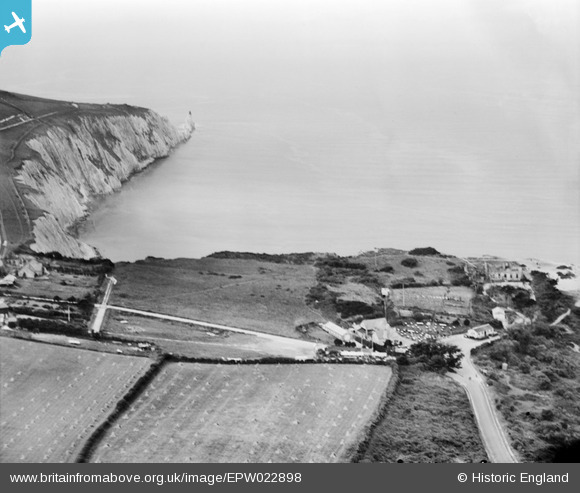
epw022898 ENGLAND (1928). The Royal Needles Hotel and environs, Totland, 1928
© Copyright OpenStreetMap contributors and licensed by the OpenStreetMap Foundation. 2025. Cartography is licensed as CC BY-SA.
Nearby Images (3)
EPW022898

EAW038609

EPW000800

Details
| Title | [EPW022898] The Royal Needles Hotel and environs, Totland, 1928 |
| Reference | EPW022898 |
| Date | August-1928 |
| Link | |
| Place name | TOTLAND |
| Parish | TOTLAND |
| District | |
| Country | ENGLAND |
| Easting / Northing | 430524, 85380 |
| Longitude / Latitude | -1.5680416017118, 50.666708247066 |
| National Grid Reference | SZ305854 |
Pins
Be the first to add a comment to this image!
User Comment Contributions
The original Royal Needles Hotel building, which burnt down on 20th February 1910, can be seen as a ruin on the clifftop to the right of the photo. The stables and Hotel Tap survived, the latter is now part of The Pantry restaurant. |
 Firecrest64 |
Friday 21st of September 2012 10:19:25 PM |