
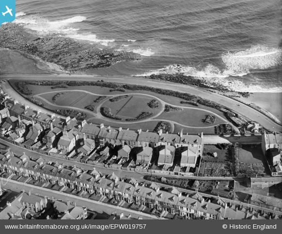
epw019757 ENGLAND (1927). Percy Gardens, Tynemouth, 1927
© Copyright OpenStreetMap contributors and licensed by the OpenStreetMap Foundation. 2026. Cartography is licensed as CC BY-SA.
Details
| Title | [EPW019757] Percy Gardens, Tynemouth, 1927 |
| Reference | EPW019757 |
| Date | 18-October-1927 |
| Link | |
| Place name | TYNEMOUTH |
| Parish | |
| District | |
| Country | ENGLAND |
| Easting / Northing | 437064, 569700 |
| Longitude / Latitude | -1.4202366553041, 55.020389602218 |
| National Grid Reference | NZ371697 |
Pins

cheviotwalks |
Tuesday 14th of October 2014 11:12:44 PM | |
|
Stuart |
Saturday 30th of June 2012 10:13:11 AM |
User Comment Contributions
They were magnificent houses on the front, I think that sort of inlet on the rocks was called Old Nelly's Gut. |
Ian Tindal |
Tuesday 26th of June 2012 09:30:58 PM |