
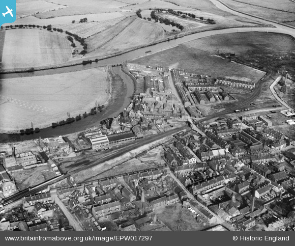
epw017297 ENGLAND (1926). The Castleford Potteries and Raglan Hearthrug Works and environs, Castleford, 1926
© Copyright OpenStreetMap contributors and licensed by the OpenStreetMap Foundation. 2025. Cartography is licensed as CC BY-SA.
Nearby Images (2)
EPW017297

EPW017298

Details
| Title | [EPW017297] The Castleford Potteries and Raglan Hearthrug Works and environs, Castleford, 1926 |
| Reference | EPW017297 |
| Date | October-1926 |
| Link | |
| Place name | CASTLEFORD |
| Parish | |
| District | |
| Country | ENGLAND |
| Easting / Northing | 441882, 425858 |
| Longitude / Latitude | -1.36514113722, 53.727215476082 |
| National Grid Reference | SE419259 |
Pins

dyey |
Tuesday 12th of January 2021 05:34:46 PM | |
|
dyey |
Sunday 13th of January 2019 09:36:16 PM | |

Derekdye |
Saturday 12th of January 2013 07:38:52 PM | |
|
Derekdye |
Saturday 12th of January 2013 07:38:10 PM | |
|
Derekdye |
Saturday 12th of January 2013 07:37:11 PM | |
|
Derekdye |
Saturday 12th of January 2013 07:33:25 PM | |
|
Derekdye |
Saturday 12th of January 2013 07:30:28 PM | |
|
Derekdye |
Saturday 12th of January 2013 07:28:09 PM | |

Cabby |
Saturday 15th of September 2012 09:32:50 PM | |
I believe it is an ox bow of the river Calder, the river that is just below it in the photograph. |
Derekdye |
Saturday 12th of January 2013 07:25:56 PM |
|
Cabby |
Saturday 15th of September 2012 09:31:43 PM | |
the river Calder as above. |
Derekdye |
Saturday 12th of January 2013 07:26:36 PM |
|
David |
Wednesday 27th of June 2012 03:17:33 PM | |
|
David |
Wednesday 27th of June 2012 03:17:25 PM |