
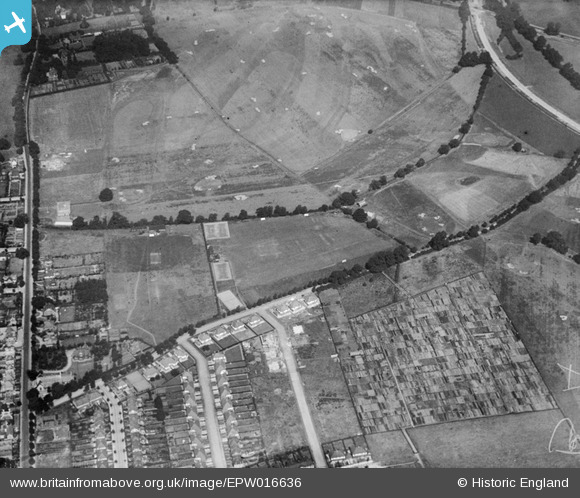
epw016636 ENGLAND (1926). Malden Golf Course and the Alric Avenue Allotment Gardens, New Malden, 1926
© Copyright OpenStreetMap contributors and licensed by the OpenStreetMap Foundation. 2025. Cartography is licensed as CC BY-SA.
Details
| Title | [EPW016636] Malden Golf Course and the Alric Avenue Allotment Gardens, New Malden, 1926 |
| Reference | EPW016636 |
| Date | August-1926 |
| Link | |
| Place name | NEW MALDEN |
| Parish | |
| District | |
| Country | ENGLAND |
| Easting / Northing | 521502, 169273 |
| Longitude / Latitude | -0.25282317564266, 51.408952929438 |
| National Grid Reference | TQ215693 |
Pins

User Comment Contributions
Christ Church and its vicarage on the left. Then Cambridge Ave with Hoppingwood, Orchard and Rosebery off it. At the bottom are 61 - 67 Alric Avenue. |

alany |
Thursday 28th of June 2012 03:35:24 PM |