
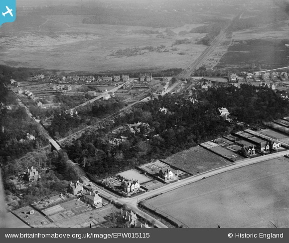
epw015115 ENGLAND (1926). Streetly Wood and Sutton Park, Streetley, 1926
© Copyright OpenStreetMap contributors and licensed by the OpenStreetMap Foundation. 2025. Cartography is licensed as CC BY-SA.
Nearby Images (2)
EPW015115

EPW015114

Details
| Title | [EPW015115] Streetly Wood and Sutton Park, Streetley, 1926 |
| Reference | EPW015115 |
| Date | 12-April-1926 |
| Link | |
| Place name | STREETLY |
| Parish | |
| District | |
| Country | ENGLAND |
| Easting / Northing | 408430, 298751 |
| Longitude / Latitude | -1.8755605381289, 52.586142358061 |
| National Grid Reference | SP084988 |
Pins

Simon Lock |
Saturday 21st of June 2014 11:15:01 PM | |
This must be Hardwick Road - no railway bridge on Foley Rd East. |
Guy L |
Friday 5th of September 2014 05:59:08 PM |
|
Simon Lock |
Saturday 21st of June 2014 11:13:54 PM |
User Comment Contributions
Still recongisable today. T-junction in foreground is Hardwick Road East with Featherstone Road off to the right. Streetly Wood is behind, with the railway cutting behind that. The line passes under Thornhill Road near the centre of shot and into the park. |
K S Clark |
Friday 19th of October 2012 07:33:31 PM |