
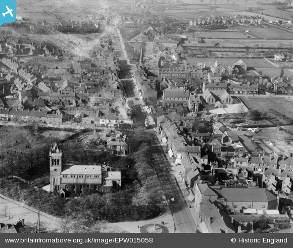
epw015058 ENGLAND (1926). All Saints' Church and the High Street, Bloxwich, 1926
© Copyright OpenStreetMap contributors and licensed by the OpenStreetMap Foundation. 2025. Cartography is licensed as CC BY-SA.
Details
| Title | [EPW015058] All Saints' Church and the High Street, Bloxwich, 1926 |
| Reference | EPW015058 |
| Date | 12-April-1926 |
| Link | |
| Place name | BLOXWICH |
| Parish | |
| District | |
| Country | ENGLAND |
| Easting / Northing | 399805, 302034 |
| Longitude / Latitude | -2.002880432066, 52.615724569894 |
| National Grid Reference | SJ998020 |
Pins

Clare Maughan |
Monday 7th of February 2022 12:50:55 PM | |

Class31 |
Monday 17th of June 2013 10:46:12 AM | |
|
Class31 |
Monday 17th of June 2013 10:45:03 AM | |
|
Class31 |
Monday 17th of June 2013 10:43:45 AM | |
|
Class31 |
Sunday 26th of May 2013 10:10:15 AM |
User Comment Contributions
View looking north. |
Class31 |
Monday 17th of June 2013 10:46:32 AM |
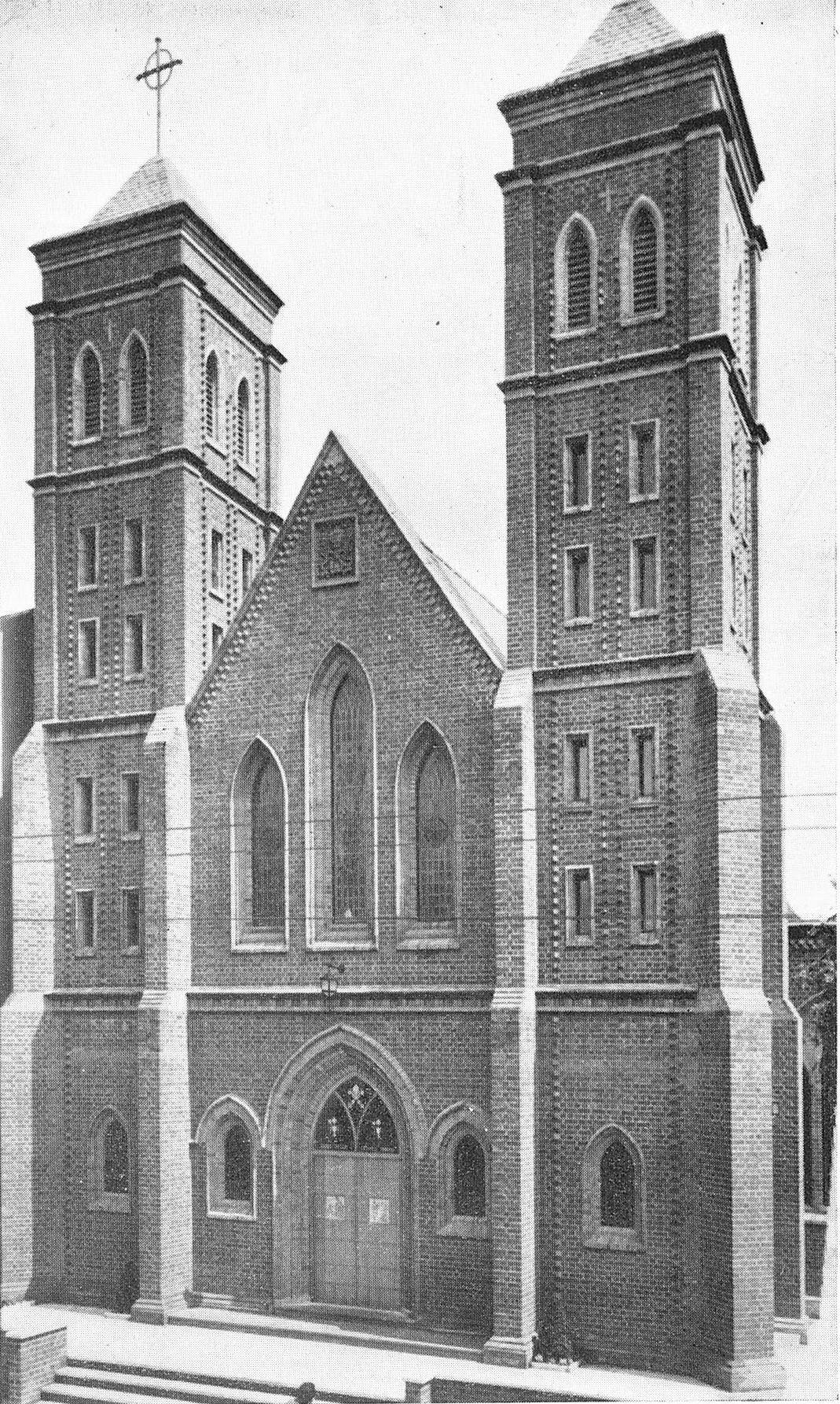
This is the new church facade. |
Jim Pearson |
Friday 29th of March 2013 11:47:50 AM |
St Peter's RC church, in the middle of the picture and right of High St, was enlarged in 1954. My dad did the plastering (he had a bit of help). St Peter's School, behind the church, had an air raid shelter built in the playground in the war. This has now been demolished, along with the school, to make way for houses. |
Jim Pearson |
Friday 29th of March 2013 11:46:11 AM |