
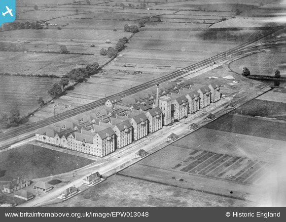
epw013048 ENGLAND (1925). The Bass Maltings, Sleaford, 1925. This image has been produced from a copy-negative.
© Copyright OpenStreetMap contributors and licensed by the OpenStreetMap Foundation. 2026. Cartography is licensed as CC BY-SA.
Details
| Title | [EPW013048] The Bass Maltings, Sleaford, 1925. This image has been produced from a copy-negative. |
| Reference | EPW013048 |
| Date | June-1925 |
| Link | |
| Place name | SLEAFORD |
| Parish | SLEAFORD |
| District | |
| Country | ENGLAND |
| Easting / Northing | 507439, 345249 |
| Longitude / Latitude | -0.3991001580897, 52.993472163379 |
| National Grid Reference | TF074452 |
Pins

Kentishman |
Monday 16th of February 2026 09:07:04 PM | |

bescotbeast |
Saturday 7th of February 2015 11:51:13 AM | |
|
bescotbeast |
Saturday 7th of February 2015 11:50:37 AM |