
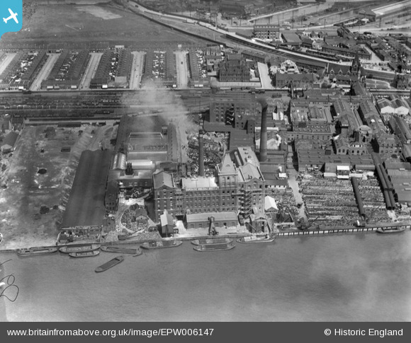
epw006147 ENGLAND (1921). The Co-Operative Wholesale Society Ltd, Silvertown, 1921
© Copyright OpenStreetMap contributors and licensed by the OpenStreetMap Foundation. 2026. Cartography is licensed as CC BY-SA.
Nearby Images (21)
EPW006147

EPW046144

EPW046142

EPW046141

EPW006303

EPW006149

EPW046139

EPW046140

EAW021111

EPW006577

EPW006578

EPW056670

EPW056669

EPW006579

EPW056673

EPW056667

EPW056671

EPW046143

EPW056672

EPW056668

EPW006148

Details
| Title | [EPW006147] The Co-Operative Wholesale Society Ltd, Silvertown, 1921 |
| Reference | EPW006147 |
| Date | April-1921 |
| Link | |
| Place name | SILVERTOWN |
| Parish | |
| District | |
| Country | ENGLAND |
| Easting / Northing | 541735, 179950 |
| Longitude / Latitude | 0.042218516350886, 51.500209261165 |
| National Grid Reference | TQ417800 |


