
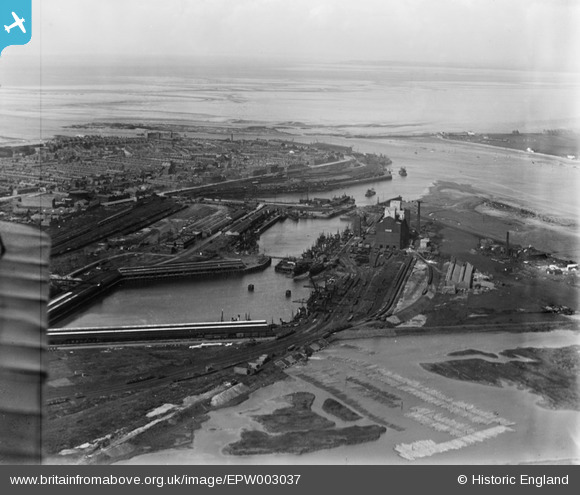
epw003037 ENGLAND (1920). The Timber Pond, Fish Dock and Wyre Dock, Fleetwood, from the south-west, 1920
© Copyright OpenStreetMap contributors and licensed by the OpenStreetMap Foundation. 2025. Cartography is licensed as CC BY-SA.
Nearby Images (11)
EPW003037

EPW038730

EAW023417

EPW038725

EPW038726

EPW038729

EPW038909

EPW038906

EPW038907

EPW038727

EPW038724

Details
| Title | [EPW003037] The Timber Pond, Fish Dock and Wyre Dock, Fleetwood, from the south-west, 1920 |
| Reference | EPW003037 |
| Date | July-1920 |
| Link | |
| Place name | FLEETWOOD |
| Parish | FLEETWOOD |
| District | |
| Country | ENGLAND |
| Easting / Northing | 333439, 446762 |
| Longitude / Latitude | -3.0134211744486, 53.912526459991 |
| National Grid Reference | SD334468 |
Pins
Be the first to add a comment to this image!