
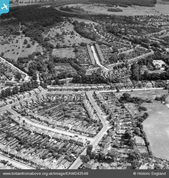
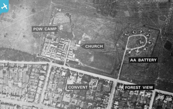
eaw043548 ENGLAND (1952). Housing around Mount Echo Drive and College Gardens looking towards Pole Hill and Chingford Plain, Chingford, 1952
© Copyright OpenStreetMap contributors and licensed by the OpenStreetMap Foundation. 2025. Cartography is licensed as CC BY-SA.
Details
| Title | [EAW043548] Housing around Mount Echo Drive and College Gardens looking towards Pole Hill and Chingford Plain, Chingford, 1952 |
| Reference | EAW043548 |
| Date | 4-June-1952 |
| Link | |
| Place name | CHINGFORD |
| Parish | |
| District | |
| Country | ENGLAND |
| Easting / Northing | 538007, 194461 |
| Longitude / Latitude | -0.0057625930436283, 51.631541843869 |
| National Grid Reference | TQ380945 |
Pins
 redmist |
Tuesday 2nd of November 2021 09:11:14 PM | |
redmist |
Tuesday 2nd of November 2021 09:10:30 PM | |
 |
redmist |
Tuesday 2nd of November 2021 09:10:01 PM |